Recreational Trails
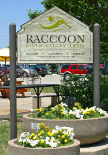
Raccoon River Valley Trail

The Raccoon River Valley Trail is an 89-mile long multi-use recreational trail that extends from Clive, in the Des Moines metropolitan area, to Jefferson. The trail is built on the former Chicago Northwestern Railroad right-of-way now owned by Dallas, Guthrie, and Greene County Conservation Boards. The trail winds its way through the Middle and North Raccoon River corridors showcasing three counties and sixteen communities. The dedication of the 33-mile North Loop in 2013 has created the 77-mile loop connecting to the Des Moines metro, and expanded our recreation trails to connect Perry with other communities on the multi-county Raccoon River Valley Trail system and The American Discovery Trail.
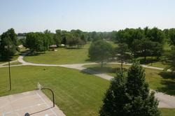
The Raccoon River Valley Trail provides the opportunity to observe nature and learn more about Iowa’s cultural history while hiking, biking, in-line skating, jogging, or just taking an evening stroll.
Recreational Opportunities mean more to small towns as they provide a common space for individuals and families to gather and explore. It is also a wonderful way to connect to our past as you will see through diligent renovations of the Brownfields Areas and the train depots.
In 2009, the trail was completed from Dawson to Forest Park Museum in Perry. In 2011, the trail from Dallas Center to Waukee was completed. The trail from Forest Park Museum to Minburn was completed in 2012, and the trail from Minburn to Dallas Center and Dawson to Herndon were opened in the spring of 2013, completing the entire 33-mile North Loop and the entire 77-mile loop of the Raccoon River Valley Trail.
Perry is now looking towards a future connection between Perry and Woodward linking the Raccoon River Valley Trail and the High Trestle Trail. Dallas County Conservation received a grant in 2013 to begin the planning phase of the trail project.
Trail permits are $10 per year or $2 per day and are available through Dallas County Conservation located at 14581 K Avenue, Perry. Permits are also available at Raccoon River Valley Bicycle Co. and an honor system payment box along the trail near the shelter house at Caboose Park.
Hiawatha Trail

The city has been using this bike trail for nearly five years, but recently began working on moving a percentage of the trail off the streets. Their goal is to double the size of all the sidewalks located in the areas to make it a bike trail.
North Raccoon River Water Trail

The North Raccoon River Water Trail enables recreational paddlers to enjoy the North Raccoon River from Vogel Access in northern Sac County to the junction with the Des Moines River in Polk County, a distance of about 180 river miles.
There are nine public access areas along the North Raccoon River in Dallas County. The furthest upstream access in Dallas County will be the Dawson Boat Ramp. This area will be constructed in the near future. About 6 miles downstream is the Perry Boat Ramp located on the north side of the HWY 141 bridge at the west edge of Perry. The next stop is Spring Valley Access 4.5 miles down the river located at the east side of County Road P58. Another 5.6 miles takes you to Snyder Access which is on the south side of County Road F31 west of Minburn. Highway 44 Access is found 4.8 miles downstream. The next access is the Kinnick-Feller Park Access which is 6.4 miles on downstream. This access is only .7 miles upstream from Adel Island Park. Both are found at the north edge of Adel. Traveling 7.5 miles downstream from Adel Island Park brings you to Puckerbrush Access. This access is located on the west side of County Road R16 about two miles north of Van Meter. Booneville Access is the last access in Dallas County, and is another 8.1 miles downstream.
All of the above public accesses have a concrete boat ramp. At each access there is a sign with the name of that access and the distance to the next access. There are also signs that point out any nearby amenities. Each bridge over the North Raccoon River has a sign visible from the water on the upstream side of the bridge that names the road the paddler is going under and tells how far it is to the next access.
